Local Community

Local area comparison
Perception of air quality in the Heathrow area is that it is particualrly poor.
The visualisation below uses data from Defra's UK Air database, this shows how the average pollution levels for Heathrow's Roadside and Background monitoring data compares to London Marylebone Road and Bloomsbury.
Roadside ⓘ
Select Pollutant
Pollutant Level


Background ⓘ
Select Pollutant
Pollutant Level


Heathrow Air Quality Working Group (HAQWG)
The Heathrow Air Quality Working Group is made up of representatives from councils, agencies, and organisations located in Heathrow’s neighbouring communities. The objectives of the group are to facilitate positive dialogue, allow members to provide updates on local progress, facilitate participation in joint projects, and raise areas for concern.
The Heathrow Air Quality Working Group reports to the Council for the Independent Scrutiny of Heathrow Airport (CISHA). CISHA is a council that oversees how Heathrow Airport interacts with its stakeholders and neighbours. For more information please visit:


Sustainability Scrutiny Project: Community views on air quality around Heathrow Airport
Council for the Independent Scrutiny of Heathrow Airport (CISHA) teamed up with Thinks Insight and Strategy to conduct a public review of the local community’s views on air quality, including perceptions of Heathrow’s actions and commitments to improve air quality. To see the full report and Heathrow’s response please visit:
Clean Air Day 2024
Clean Air Day is a significant event that brings communities together to focus on improving air quality and protecting our health and the environment.
It's a day to celebrate progress towards cleaner air and to remind us of the work that still lies ahead. Local communities and organisations across the UK have been taking a proactive approach to celebrate this day.
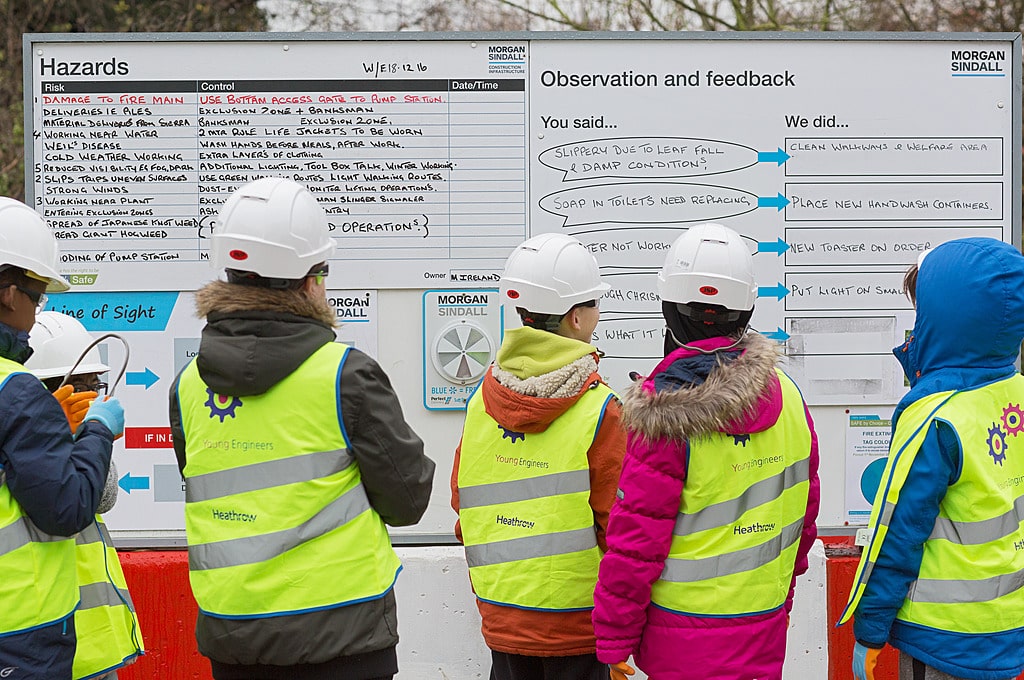
In support of Clean Air Day, Heathrow teamed up with Spelthorne Council on an Air Quality and Engagement project aimed at identifying cleaner walking routes to school. The project's goal was to compare typical walking routes using advanced air monitoring sensors.
On the day, participants walked along the school routes during the morning rush hour to measure traffic and emissions. The sensors, attached to lightweight backpacks, recorded levels of particulate matter and nitrogen dioxide. With help from Heathrow's air quality consultants, Ricardo, the team employed advanced monitoring and analysis techniques to pinpoint routes that significantly reduce pollution exposure.
These clean air walking routes are designed to minimise exposure to air pollution by offering alternative paths with lower levels of pollutants, such as nitrogen dioxide (NO2) and particulate matter (PM10 and PM2.5)

Frequently Asked Questions
-
How has local air quality changed over time?
Over the last decade Heathrow has seen huge improvements in air quality. Our air quality monitoring stations show that pollutant levels have decreased by 32%, 45% and 34% for NO2, PM10 and PM 2.5 respectively (2013 vs 2023 Annual Means).
-
How can I reduce my exposure to air pollution?
There are several useful resources online including Global Action Plans Clean Air Hub. This includes a clean air planner that helps give personalised advice to you. Clean Air Planner
Create your personalised air pollution action plan (cleanairhub.org.uk)
-
How can I reduce my contribution to air pollution?
There are several useful resources online including Global Action Plans Clean Air Hub. This includes an air pollution that helps you estimate your air pollution footprint and compare it to the national average. The tool then provides tailored advice to help you lower your contribution to air pollution:
Air Pollution Calculator (cleanairhub.org.uk)


